


Connecting the Dots: Mastering Project Collaboration with Trimble Connect
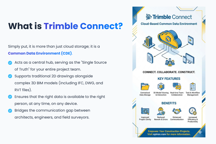
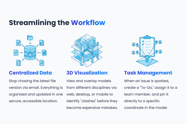
Trimble Connect is a cloud-based collaboration platform that serves as the core Common Data Environment (CDE) for the construction, architecture, and engineering industries in the digital era. Its key strength lies in seamlessly integrating all types of project data, ranging from 2D drawings and 3D models to various technical documents.
The platform empowers all stakeholders to access and manage the most up-to-date information from any device, anywhere in the world. It features robust data management capabilities that support a wide range of file formats (such as IFC, DWG, and RVT) and facilitate coordination through model overlay for early error identification (Clash Detection). Furthermore, its built-in communication and task-tracking "To-Do" System ensures that instructions flow quickly and accurately from the office to the field, sustainably reducing project delays and redundant workflows.
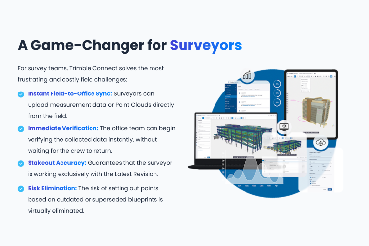
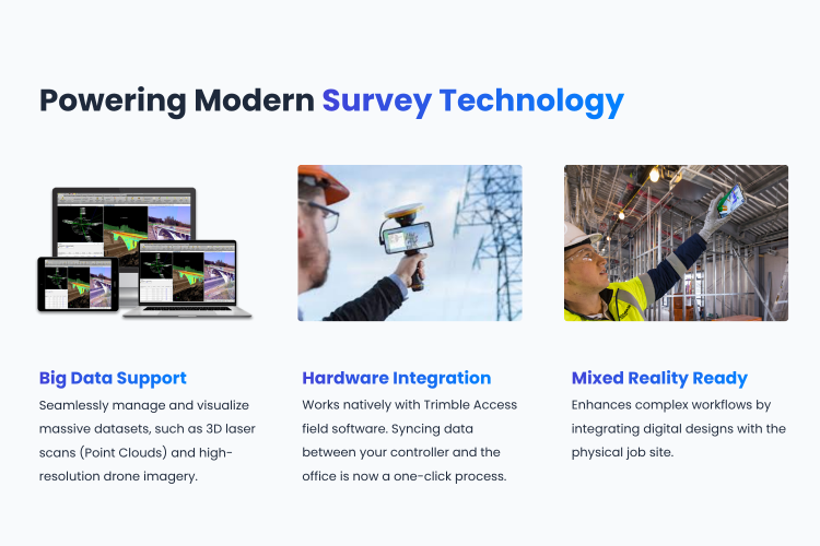
For the surveying engineering sector, Trimble Connect acts as a strategic tool that revolutionizes fieldwork, enhancing both accuracy and speed. Capable of handling massive datasets—such as 3D laser scans (Point Clouds) and drone imagery—it connects directly with field data collection software like Trimble Access. This allows survey data to be transmitted back to the office in real time, eliminating the downtime caused by waiting for the team to return from the site. Additionally, it helps guarantee the precision of site layouts and elevation checks.
Moreover, survey teams can instantly access the latest plan revisions on the cloud, completely eliminating the risks and potential construction errors associated with using outdated drawings. Ultimately, Trimble Connect is not merely a file storage space; it is a digital bridge that unifies surveying operations with the entire construction lifecycle, driving maximum efficiency for today's leading projects.
The platform empowers all stakeholders to access and manage the most up-to-date information from any device, anywhere in the world. It features robust data management capabilities that support a wide range of file formats (such as IFC, DWG, and RVT) and facilitate coordination through model overlay for early error identification (Clash Detection). Furthermore, its built-in communication and task-tracking "To-Do" System ensures that instructions flow quickly and accurately from the office to the field, sustainably reducing project delays and redundant workflows.
For the surveying engineering sector, Trimble Connect acts as a strategic tool that revolutionizes fieldwork, enhancing both accuracy and speed. Capable of handling massive datasets—such as 3D laser scans (Point Clouds) and drone imagery—it connects directly with field data collection software like Trimble Access. This allows survey data to be transmitted back to the office in real time, eliminating the downtime caused by waiting for the team to return from the site. Additionally, it helps guarantee the precision of site layouts and elevation checks.
Moreover, survey teams can instantly access the latest plan revisions on the cloud, completely eliminating the risks and potential construction errors associated with using outdated drawings. Ultimately, Trimble Connect is not merely a file storage space; it is a digital bridge that unifies surveying operations with the entire construction lifecycle, driving maximum efficiency for today's leading projects.