


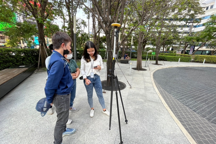
Delivered the Trimble DA2 compact GNSS and provided a training course to AFRY (Thailand) Ltd.
Our Surveying Instruments Division delivered the Trimble DA2 compact GNSS and provided a training course to AFRY (Thailand) Ltd., officers in March 2023. The aim is to use topographic maps and collect the GCPs for aerial mapping from drones.
With the well-proportioned size and light weight of just 330 g., surveyors can carry and collect geospatial data at anytime and anywhere, just only Trimble DA2 and a mobile phone. No matter there is internet or not in the field, Trimble DA2 can deliver the high accuracy position GNSS position at 2-4 centimeters as well as the costly model. Trimble Access Field software allows users to collect professional topographic maps, stake-out, and additional cogo points using different methods and export in several file formats ex: .csv, .dxf. shp etc. Simply rugged and precise – Trimble DA2.
With the well-proportioned size and light weight of just 330 g., surveyors can carry and collect geospatial data at anytime and anywhere, just only Trimble DA2 and a mobile phone. No matter there is internet or not in the field, Trimble DA2 can deliver the high accuracy position GNSS position at 2-4 centimeters as well as the costly model. Trimble Access Field software allows users to collect professional topographic maps, stake-out, and additional cogo points using different methods and export in several file formats ex: .csv, .dxf. shp etc. Simply rugged and precise – Trimble DA2.